


mont arpassé via sentier en balcon

baygonvert
User

Length
12.9 km

Max alt
690 m

Uphill gradient
582 m
Km-Effort
21 km

Min alt
218 m

Downhill gradient
577 m
Boucle
Yes
Creation date :
2024-05-05 12:49:01.461
Updated on :
2024-05-05 15:08:54.852
2h19
Difficulty : Very easy

FREE GPS app for hiking
 SityTrail
IGN / Geographical institutes
SityTrail Plus
The world is yours!
About
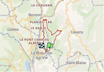
Trail Trail of 12.9 km to be discovered at Provence-Alpes-Côte d'Azur, Maritime Alps, La Roquette-sur-Var. This trail is proposed by baygonvert.
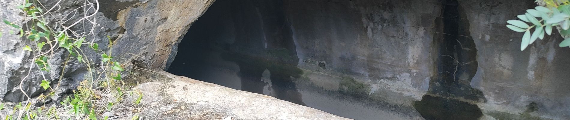
Photos

Positioning
Country:
France
Region :
Provence-Alpes-Côte d'Azur
Department/Province :
Maritime Alps
Municipality :
La Roquette-sur-Var
Location:
Unknown
Start:(Dec)
Start:(UTM)
355524 ; 4854611 (32T) N.
Comments